The Wormsloe Institute: Exploring the Landscape in Layers
Savannah, Georgia

Perhaps it is her experience piloting a research submarine that leads Sarah Ross to approach landscape history from underground. “Landscape demands this approach,” says Ross, president and director of the Wormsloe Institute for Environmental History. Although Ross did use a sub to map the ocean bottom and tracked for a time at the National Oceanographic and Atmospheric Administration, where she later became the agency’s director of education, her method derives more from her broad background in science than from her underwater adventures in particular. From a scientific point of view, she explains, landscape is dynamic, composed of matter and organisms that constantly interact, both below and above the soil.
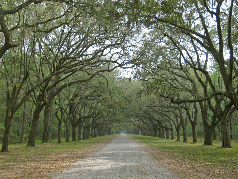
Which means that Ross and her colleagues at the Wormsloe Institute have a lot of ground to cover. On the surface alone, the site includes the more than 1,200 acres of the original 1730s Wormsloe plantation, thanks to cooperation among the entities that now own various portions of it. To explore as many layers of the land as possible, Ross introduced interdisciplinary teams that now include geographers, ecologists, historians, designers, anthropologists, archaeologists, geologists, and foresters, all from the University of Georgia. The purpose of research in any discipline at the Institute “is to enhance knowledge in that field and to advance best practices in the region,” Ross explains. “We consciously strive to ensure that our research has application beyond our site.”
Not long after launching the Wormsloe Institute with Craig Barrow III in 2007, Ross saw that new technologies could map the property in all its dimensions—physical, cultural, environmental, and historical—and she enlisted members of the University of Georgia Center for Geospatial Research to help design all-inclusive baseline maps. “We have been collecting geospatial data using global positioning system surveys, historical and contemporary maps, aerial photographs, and aerial and terrestrial LiDAR data,” says Ross, explaining that LiDAR is a type of radar that produces three-dimensional images from two-dimensional ones, revealing the precise size and location of buried objects. To conduct aerial LiDAR surveys, Wormsloe Institute is working with military and federal agencies; the technology is so new that it is not yet available to civilians. This and other innovative technology allows researchers to create overlap maps of extraordinary richness and detail and allows them to remove objects in the least invasive way possible. “We remove the object with minimal disturbance to the site, capture data about it, and immediately return it to the soil. . . . That data becomes part of a working bank of knowledge that can be accessed immediately and precisely.”
To share these mapping and archaeological techniques with the widest possible network, Ross and Barrow are applying for UNESCO World Heritage status for the site. Ross cannot wait for a UNESCO team to visit. “I want them to say that everything we do here is of the highest and best value in all fields and exemplary in all ways.”
—Jane Roy Brown