LEGACY HERO: Jack Dangermond, Redlands, California (2019)

In the last decades of the twentieth century, the mapping and spatial analytics software created by Jack Dangermond and the company he founded, Esri, transformed the professions of landscape architecture and urban and regional planning. Through his Redlands, California, firm and its suite of geographic information system (GIS) products known as ArcGIS, Dangermond revolutionized the science and technology of geographic data collection. “[Mapping is] one of the areas of technology that has gone further than I ever expected,” Microsoft cofounder Bill Gates told Forbes magazine in 2016. “And we have Jack Dangermond to thank, in large part, for his pioneering efforts of almost fifty years.” “[Dangermond] kind of created the industry,” says John Hanke, who for several years led Google’s mapping initiatives. “Products like Google Earth, Google Maps, and Google Street View,” Hanke says, “were built on the shoulders of what he created.” Dangermond holds degrees in both landscape architecture and urban planning. His intellectual lineage extends back to Charles Eliot, who pioneered the use of overlay maps in land use analysis in the 1880s and ’90s, and to Warren H. Manning, who applied Eliot’s methods on a regional and, eventually, national scale.
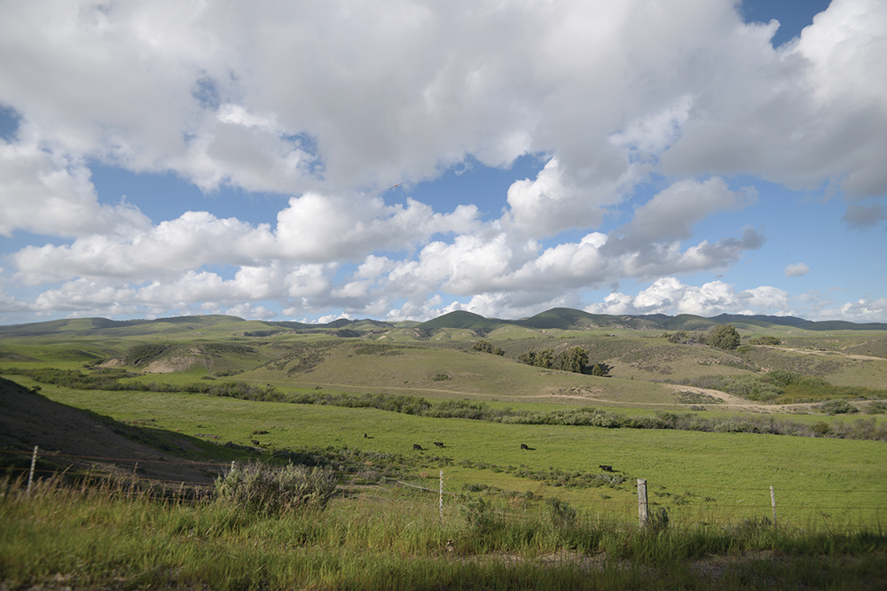
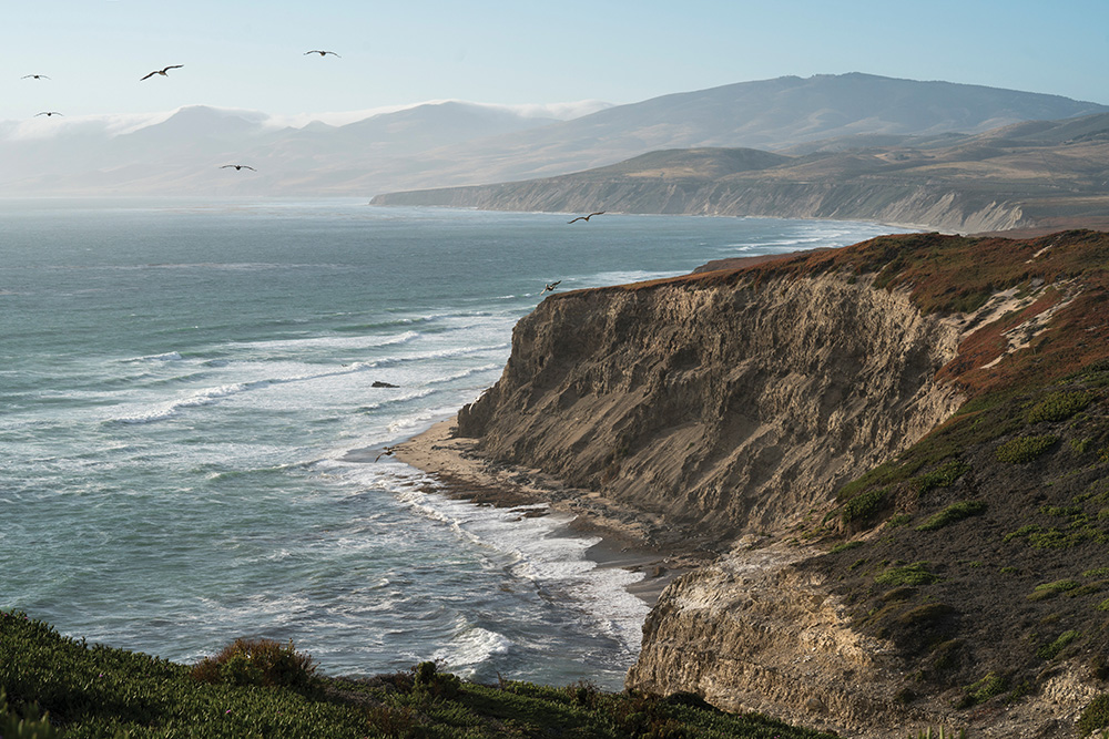
Jack and his wife, Laura Dangermond, have also long been committed to philanthropy and preservation. In 2017, they made a gift of $165 million to The Nature Conservancy, enabling the purchase of a 24,000-acre parcel of land on the California coast north of Santa Barbara, the largest single charitable donation ever received by the organization. Now known as the Jack and Laura Dangermond Preserve, the site comprises four ecoregions—two terrestrial and two marine—with eight miles of coastline. Topography ranges from sea level to 1,900 feet, in the Santa Ynez Mountains. The Dangermonds’ fervent wish is that the parcel will become “one of the world’s most studied preserves.” Scientific research on climate change, migration patterns of birds and animals, and population counts of various flora and fauna are already in the works.
Esri celebrated its fiftieth anniversary this year, and at its GeoDesign Summit in Redlands, LALH president Daniel J. Nadenicek and LALH director Robin Karson awarded Dangermond the organization’s highest honor, the Legacy Award, “in recognition of his transformative contributions to the practice of landscape architecture.” In accepting, Dangermond spoke of his desire to use “rational thinking, science-based thinking, to create a better future.” Preserving the health of the earth and the species that inhabit it has been key to Dangermond’s philanthropy, and his abiding interest in the use of digital mapping to better understand the environment has guided his life’s work.
Dangermond has spent most of his life thinking about landscapes and nature. He grew up in Redlands, where his parents, immigrants from the Netherlands, founded and ran Dangermond’s Nursery. Working there as a teenager, he learned every aspect of the business, from finance to the care of plants, and he gained field experience as well, on landscape projects alongside nursery crews. He and Laura met in high school, and they both attended California State Polytechnic University, Pomona, where Jack received a bachelor’s degree in landscape architecture in 1967. He went on to earn a master’s degree in urban planning from the University of Minnesota in 1968 and a master’s degree in landscape architecture from Harvard University Graduate School of Design in 1969. While at Harvard, he worked in a computer lab where some of the century’s first mapping software was conceived.
After completing his degree at Harvard, Jack returned to Redlands and, with Laura, founded Esri. Initially focused on consulting and built technology for land use analysis, the company soon shifted to building GIS software for others. “I founded Environmental Systems Research Institute in 1969,” Dangermond writes, “with a vision that computer mapping and analysis could help us design a better future. That vision has continued to guide Esri in creating cutting-edge GIS and GeoDesign technologies used in every industry to make a difference worldwide.”
In Nadenicek’s words, Esri mapping software is a “sophisticated toolkit for geospatial analysis.” It allows users to apply science to design by aggregating data from many different sources in a systematic way, to map landscapes and urban spaces in real time, and to plan for their use and evolution. ArcGIS, the company’s flagship software, can be used to create maps that compile information about storm damage, for example, or wildfires, the spread of disease, or traffic patterns, among countless other applications. Both the scale of use of the program and the level of detail in the maps it can create are unprecedented, allowing for participatory design “like it’s never been done before,” says Nadenicek.
Today, Esri software is used by 350,000 businesses, government agencies, and NGOs around the world; the company provides pro bono technical assistance and training, and it frequently makes the program available to nonprofits free of charge. In 2014, Esri pledged to donate ArcGIS Online to every public, private, and home school in the U.S., and to offer the online program free of charge to primary and secondary schools and vocational institutions globally. Over the past five years, Esri has donated $11 million worth of technology to the Audubon Society which has been instrumental in developing conservation strategies.
“The Nature Conservancy has already begun creating an incredibly detailed map of the Dangermond Preserve with hundreds of layers of data,” says Damian Spangrud, Esri director and representative to the Preserve. “This is being used for assessment and modeling across many disciplines.” Dangermond speaks of using this software to create a “digital twin” of the property, “so that as we intervene in natural systems, we can better understand the impacts of those interventions.” Deeply committed to conservation and the protection of these “special” areas, Jack and Laura Dangermond hope that their actions will inspire others to follow suit. “Some places on our planet should be preserved so that they continue evolving and let nature rule,” Dangermond told Landscape Architecture magazine, “and this is one.”
—Jonathan D. Lippincott